
Drones: mapping
Drones are an excellent method to acquire aerial imagery on demand, and with a very low cost. Even simple drones, like the Phantom III and Mavic that we are using, have good quality cameras, that can take high resolution pictures. By taking a lot of pictures, with borders largely overlapped, it is possible to obtain good orthophotos, i.e., images that are georeferenced and have a good correspondence with the spatial ground truth. Using the same approach it is possible to obtain digital elevation models (DEM), that is to say models of the terrain that show good accuracy not only of the geographic position, but also of the altitude.
A digital elevation model of Sea Lion Island
Orthophotos and DEM can be used to support various kind of environmental research and monitoring goals. For example, they can be used to estimate haul out habitat suitability for pinnipeds or distribution of vegetation communities.
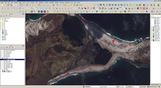
Distribution of elephant seal harems (red polygons) visualized in GIS software
An added value of using drones at Sea Lion Island is that we can fly them over the nearby Rum Island.
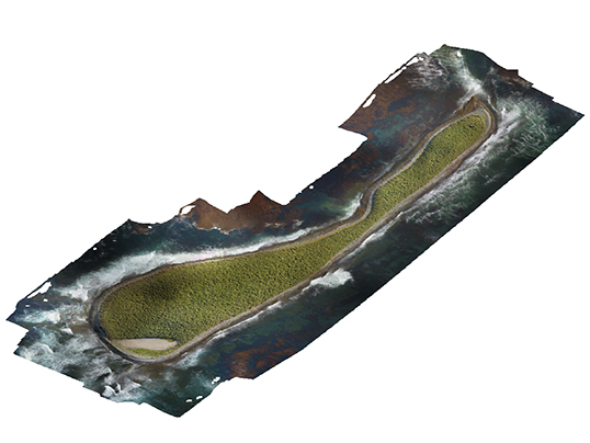
Orthophoto of Rum Island obtained from drone images
For more information please contact us by email at fil_esrg@eleseal.org. Thank you for your interest in our research projects !