
Drones: intro
The Elephant Seal Research Group is using drones to support environmental research and monitoring. Being strinctly limited in funding, we are currently using twosemi-professional drones by DJI, a Phantom 3 and a Mavic. Although they are somehow limited in theor capabilities, it is pretty easy to fly them, and they have rather good cameras, so they can provide high resolution pictures and videos.
We are using our drones for various goals, including studying elephant seals and killer whales, count marine birds and map their colonies, study landscape changes, and carry out general mapping of Sea Lion Island habitats and natural resources.
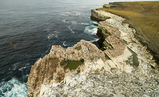
The main Sea Lion Island cormorant colony from the drone
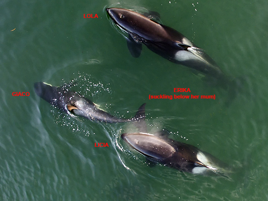
Killer whales from the drone
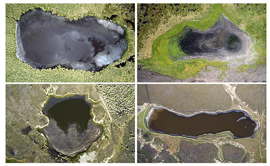
Four Sea Lion Island ponds from the drone, to study changes in water level
Seal spatial distribution and 3D modelling
For more information please contact us by email at fil_esrg@eleseal.org. Thank you for your interest in our research projects !